

How GISweaver treats ASCII DXF, binary DXF and DWG
GISweaver identifies every uploaded file by its content bytes rather than relying solely on its file extension. Because ASCII DXF begins with plain-text section headers, it can be parsed directly into interactive 2D map layers.
Binary DXF and proprietary DWG drawings are accepted and kept safely with your project and published releases, and are delivered to recipients as exact files for download—while ASCII DXF, GeoJSON, KML, KMZ, GeoPackage and zipped Shapefiles become interactive map layers on screen.
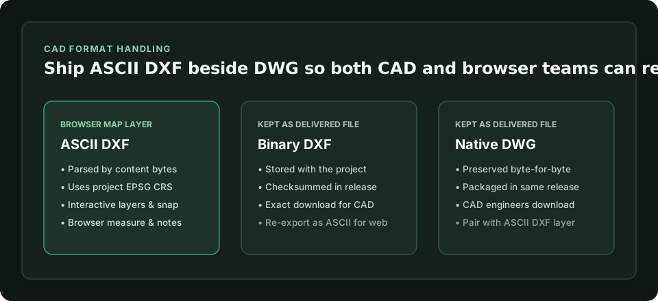
Scroll sideways to see the whole diagram
| Format | Opens as interactive browser layer | Delivered as original file |
|---|---|---|
| ASCII DXF | Yes (uses project EPSG CRS) | Yes (SHA-256 checksummed) |
| Binary DXF | No (stored as file) | Yes (SHA-256 checksummed) |
| Native DWG | No (stored as file) | Yes (SHA-256 checksummed) |
Check the full supported-formats table
How to export a clean ASCII DXF for your client release
When exporting from AutoCAD, Civil 3D, BricsCAD or QGIS for browser inspection, follow three quick checks before publishing:
- Choose ASCII DXF (not binary DXF) in your export options.
- Keep coordinates in the exact projected EPSG system of your GISweaver project (ASCII DXF carries no embedded projection file, so it uses the project’s coordinate system).
- Include the master DWG alongside the ASCII DXF in the same versioned release so CAD engineers get the native drawing and project managers can measure straight in the browser.
Never overwrite a delivered CAD link in place: publish the updated ASCII DXF and DWG pair as a new numbered release so every reviewer can trace which revision they signed off on.
Replacing email attachments with a single versioned release
Packaging the ASCII DXF review layer, master DWG, GeoTIFF orthophoto and PDF survey report inside one numbered GISweaver release ensures both CAD specialists and non-technical clients inspect the same checksummed revision.